The Miocene is a period that begins about 25 million years ago and ends about 5 million years ago. It was a geologically fundamental period for the constitution of Sardinia in its present form. Because at the beginning of this era geological Sardinia was still attached to Corsica, well close to the coast of present-day France along with much of Africa.
But let’s start from the basics: to what period do we refer when we talk about Miocene? The Miocene indicates the Cenozoic era between the Oligocene and the Pliocene and is divided into six floors including the Messinian.
This last one represents the period in which the greater event that regards the Mediterranean zone occurs, that is the crisis of salinity because of which the Mediterranean remains isolated and dries up and, as consequence, happens the deposit of sediments of chalk and rock salt.
And not only, always in this part of the Miocene, magmatic events take place in Italy that we can see in Veneto, for example, with the trachytic laccolites of the Euganean Hills, or in Sardinia with the emission of trachytic lavas that will continue after the Neogene the second period of the Cenozoic era occurred about 23.5 million years ago.
lagazzettadelmediocampidano
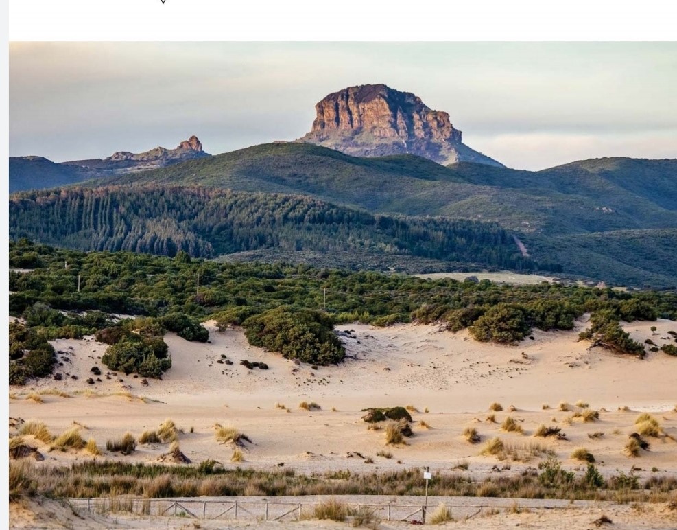
Conformation and characteristics of Sardinia in the Miocene
At the time, Sardinia was very different from what we know today: its position was in fact in front of the coasts of Provence, in France, along with Corsica, a part of North Africa and Calabria.
Sardinia and Corsica, then, formed the block known as Sardo-Corso but it was during the Miocene that the land movements began to separate the aforementioned block from the Provençal coast and to rotate it counterclockwise until it reached its current position.
These movements are very slow, of a few millimeters every year, so much so that the change of position ended definitively about 16 million years ago.
These movements, however, did not happen without consequences: in fact, the plates affected caused immense fractures and the displacement of entire blocks of the earth’s crust.
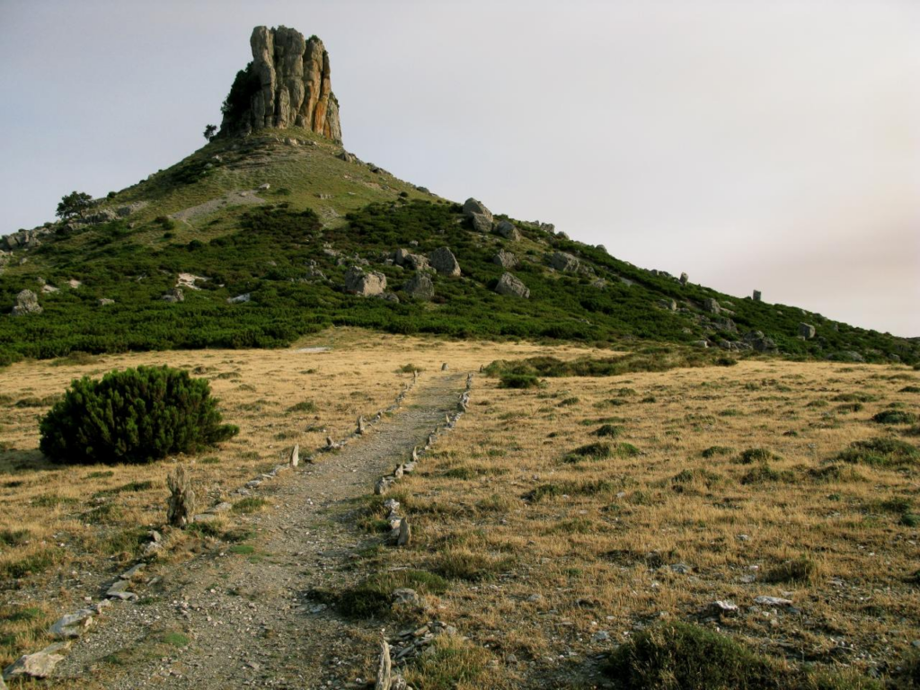
From the deepest cracks emerged the magma, giving rise to one of the periods of greatest volcanic activity in Sardinia: so many volcanoes of explosive type were formed, of which, to date, there is almost no trace and, with the passage of time, the volcanic material belonging to this phase turned into rock.
The geology of Sardinia: among the most interesting and studied in Europe
Why do scholars care so much about the geological history of Sardinia? First of all because, through its vicissitudes, it can tell more than 570 million of European geological history, as no other region can do.
It was a recent study, conducted by the National Institute of Geophysics and Volcanology together with the University of Roma Tre, that brought to light new information about the current configuration of Sardinia.
Wikipedia
According to the results of the study, the island would be the result of the union of two independent tectonic micro plates, which occurred between 30 and 21 million years ago then, in part, also during the Miocene.
These studies are the result of decades of research because, for example, it would have been impossible to conduct them without the paleomagnetic data collected in Sardinia and Corsica during the seventies; these testify to the separation of the Sardinian tectonic blockfrom the European Provençal-Catalan margin, occurred about 21 million years ago when the block, rotating about sixty degrees counterclockwise, has reached its current position.
The data collected during the twentieth century were, therefore, fundamental for the conduct of the most recent studies that, in turn, have shed even more light on the geology of Sardinia, highlighting new information such as, for example, the fact that the southern partwestern region of Sardinia has undergone a greater rotation of about 90 degrees.
In addition, the researchers reviewed data already collected in the past and made a further step forward, discovering that the southern portion of Sardinia has undergone an even greater rotation, of almost 120 degrees.
The results of these more recent studies state, therefore, that Sardinia was formed by the union of two independent plates: one was part of a single block with Corsica and Provence, the other belonging to the Iberian Plate.
Moreover, they suggest that the southern plate, the Iberian, was initially much larger because it was joined to the Balearic Islands, the Calabro-Peloritano block, the Kalibi blocks and the Alboran block, which correspond respectively to northern Algeria, to Morocco and Andalusia.
Today the most popular theory to describe the continents is the dynamic model of plate tectonics, which provides that the lithosphere is composed of about 15 plates or plates, 100 to 200 km deep. Under it, in the asthenosphere the rocks would maintain the same composition but would be partially melted. The plates always move, but their movements are appreciable on a geological scale, that is, in millions of years.
Copertina: parcgenoni